Neighborhood Maps
Select Your Type of Map
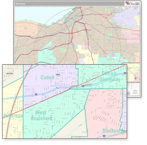
Neighborhood boundaries are
more relevant in areas of high
urban density where informal
spaces are meaningful. The
boundaries which we use to
create our maps are
geographically encoded to
provide the precise latitude and
longitude for every neighborhood.
This information is compiled
using thousands of resources
that include from a worldwide
team of Neighborhood
Researchers to representatives
of the real estate, tourism and
hospitality industries, as well as
retail and local media outlets.
Neighborhood boundaries are updated on a periodic basis to assure the most
accurate boundaries at any given time. ZIPCodeMaps' expertise and leadership
in the mapping world bring you state-of-the-art maps in multiple formats, sizes,
and styles. Select the map you need with neighborhood boundaries from our
county maps or create your own map using our highly specialized custom
mapping services.


